Most fire departments have few information about fire scenarios and the well-being of firefighters who are fighting it.
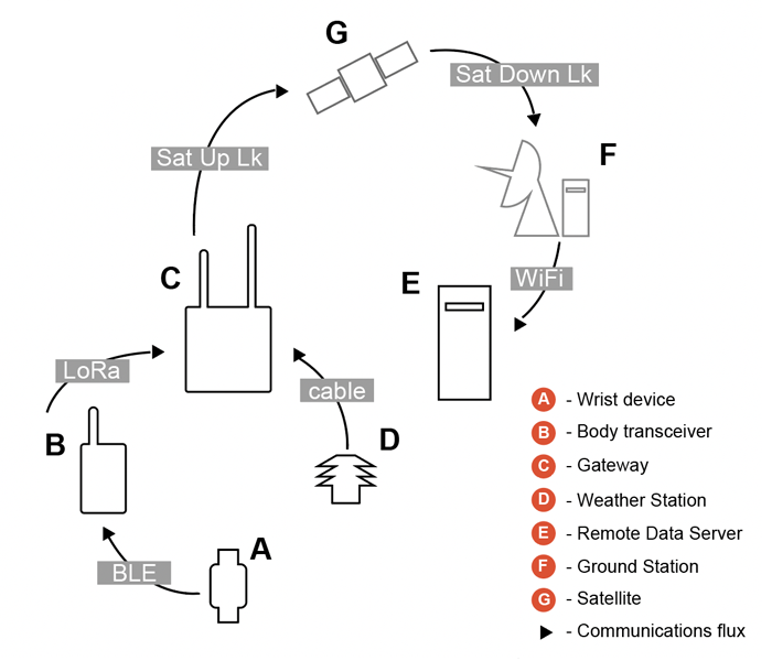
FireDat measures positioning and several indicators of the firefighters through specific wearables and other devices placed on the command vehicles gathering environmental indicators.
FireDat provides Fire Departments several layers of real-time information, about the location, well-being of firefighters, geo-spatial and environmental information, so that they can make more accurate decisions and save lives.
FireDat uses Copernicus Earth Observation Satellites, Galileo GNSS positioning and Satellite Communication.